 Follow Us on Google Discover
Lagos State is moving to institutionalise the use of geospatial data in managing land, infrastructure and urban development as the government grapples with the growing scale and complexity of the state.
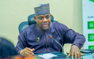
Special Adviser to Governor Babajide Sanwo-Olu on e-GIS and Urban Development, Olajide Babatunde, said the ability to understand where land is located, how it is being used and how infrastructure and communities are changing is becoming critical to effective governance in Lagos.
Babatunde made the remarks in his message marking the inaugural Lagos GIS Day, where the state highlighted its expanding geospatial infrastructure and the establishment of the Lagos Geographic Information Service (LAGIS).
Lagos seeks better data for land and urban planning
According to Babatunde, the central challenge for Lagos is how to effectively manage a city characterised by its scale, complexity and constant change.
He said government needs reliable information on the location and use of land, the development of roads and other infrastructure, changes in communities and the relationship between different parts of the state to make effective decisions.
- “Geospatial information provides the value needed to understand the state not only through what is visible, but through information that shows where things are, how they connect and how they change,” Babatunde said.
The emphasis on spatial data comes as Lagos continues to expand its digital mapping infrastructure, including detailed mapping data, orthophotos and LiDAR imagery, which can provide more granular information for planning and monitoring the physical environment.
The state has also demonstrated artificial intelligence applications being developed around its digital mapping data, pointing to potential applications beyond conventional mapping.
LAGIS to bring geospatial systems under one framework
Babatunde described the institutionalisation of LAGIS as an important step towards bringing Lagos’ various geospatial initiatives together under a stronger framework.
He said the new structure would strengthen how the state creates, manages and uses spatial information for government purposes.
Lagos began developing its electronic Geographic Information System capability in 2016, while the Lagos e GIS Office was formally established in 2021 to coordinate the development and integration of the state’s geospatial systems.
The Lagos State House of Assembly subsequently adopted recommendations on the Lagos Geographic Information Service Bill in 2025. Governor Babajide Sanwo-Olu assented to the legislation on October 6, 2025, establishing LAGIS and declaring October 6 as Lagos GIS Day in perpetuity.
The inaugural GIS Day also featured the inauguration of the LAGIS Board and its first meeting at the LAGIS Building.
Digital mapping expands potential uses of spatial data
The state showcased its geospatial infrastructure at the Lagos GIS Centre, including the ABAT III eGIS Data Centre and the completed digital mapping project.
The project includes orthophotos and LiDAR imagery, while officials also presented the Lagos Property Bank and demonstrated AI applications being developed using the mapping data.
Sanwo-Olu also visited the Land Archive at the Lands Bureau, where he inspected the facility and observed the process of archiving manual land records.
He subsequently visited the Ikeja Regional eGIS Centre, where officials presented prototypes for proposed regional eGIS centres covering Epe, Ikorodu and Badagry.
The expanding geospatial infrastructure is expected to provide government with more detailed spatial intelligence for land administration, infrastructure planning, urban development and other areas where location based data is required for decision-making.
Land administration takes new shape in Lagos
As part of efforts to improve land governance and expand the formal property market in the state, Lagos State Government in January this year launched a statewide initiative to identify, document, and formalise informal land assets estimated at about N3 trillion.
- The exercise involves mapping, valuation, and integration of undocumented land parcels across the state.
- Informal land assets refer to properties without formal documentation such as Certificates of Occupancy or registered titles.
- The project is being implemented following approval from Governor Babajide Sanwo-Olu, with Octragon Multi Projects appointed as consultant.
- The scope has expanded from an initial 2,000 hectares to 3,744 hectares valued at about N3 trillion.
The initiative also aligns with Lagos’ broader digital land reform agenda aimed at improving transparency and unlocking economic value from previously undocumented assets.
In a similar development, the state has automated building approval processes through the Electronic Physical Planning Process System (EPPPS), shifting planning permit applications and construction approvals to a fully digital platform.